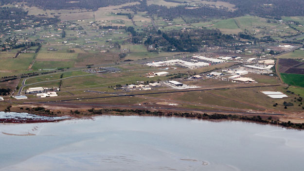
The photo above shows Hobart/Cambridge aerodrome as it was in May 2011. The photo can be compared with the diagram below, which shows the main layout of the aerodrome, including the runways, taxiways and apron areas in roughly the same orientation. A major change is the new Runway 13/31 along the shore of Barilla Bay, which was under construction at the time the photo was taken. The encroaching industrial area on the south-western side of the aerodrome also makes a contrast to earlier aerial photos.
Roll your cursor over the image to get labels for some of the main features.
Compare with the 1955 layout of the aerodrome.
Cambridge is located inside the Hobart Control Zone and as such is controlled from Hobart Tower, which is located on a hill out of shot to the left, between Cambridge and the 'new' airport at Llanherne.
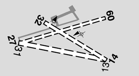
(Photo: Phil Vabre / Diagram: Airservices Australia [ERSA 2013])
Back to the main Airports & Aerodromes index
If this page appears without menu bars at top and left, click here